Hiking tours in Lanzarote

The hiking trails presented here offer the guarantee and peace of mind of knowing that they have been conceived by professionals, 100% approved and marked. Of course, it’s advisable to wear suitable clothing and footwear and don't forget sun protection and drinks to enjoy these walking routes in Lanzarote.
1. Camino de los Gracioseros (9 km)

The first trekking route in Lanzarote takes us to an ancient path used by the gracioseros (inhabitants of La Graciosa, officially the eighth island of the Canary archipelago for some years now) to get to and from the island of Lanzarote.
It’s a circular route that runs along the cliffs of Famara with La Graciosa and the rest of the Chinijo Archipelago in sight beyond the Rio Strait. The path through volcanic rocks, with some slippery parts, ends at sea level. As a reward, a swim in the blue waters of the Río is well worth the effort.
To begin the route, take the detour to the Mirador del Rio viewpoint (one of the most spectacular architectural creations of the famous island artist César Manrique), located at the exit of the village of Yé in the direction of Guinate.
This is a very charming hiking route in Lanzarote, with spectacular views of the coastal area, with a first stretch of cobblestones, where the descending path develops in zigzag. In addition to the walk, this trekking allows you to get to know the important flora and fauna of the area, with numerous endemic and protected species.
Thus, the route passes through two different environments: it starts by the cliff of Famara, where rock vegetation and lichen formations predominate at the top, while the coastal platform is dominated by tabaibal (an endemic plant) and a good representation of the species of the coastal halophilic belt. The presence of birds is abundant in this area, both marine and birds of prey on the cliffs.
The heritage values of this area, in addition to the intrinsic value of the path itself, are the archaeological sites and the Salinas del Rio salt mine, the oldest in the Canary Islands, which still maintain their original layout, as they were in operation until well into the 20th century.
There is written testimony of their adaptation in 1520 from a previous pre-Hispanic aboriginal use linked to ancient pastoral uses of this plain of Famara, with dry stone structures on the slopes (some of a residential nature and others associated with livestock use) that were reused after the arrival of the Europeans.
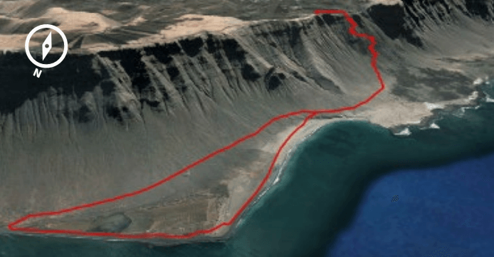
TECHNICAL DATA
- Distance: 9 km
- Duration: 3 hours
- Slope: 358 metres
- Difficulty: high

2. Caldera Blanca (6 km)
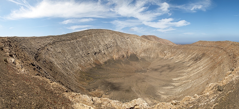
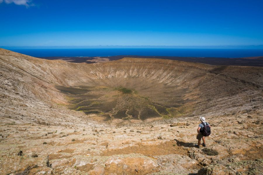
The second hiking route in Lanzarote runs through the centre of the island, crossing an area of volcanic badlands abundant in lava forms, the result of eruptions that occurred between 1730 and 1736.
Its two central elements, Caldereta and Caldera Blanca (one of the main heights of the volcanic chains in the centre of Lanzarote) craters, have their origin in two ancient cones produced by previous eruptions.
Most of the route passes through historic badlands, where the lava erased the traces of human presence prior to the 18th century. Thus, the route runs through an area with little anthropic presence, except for some elements linked to livestock use.
This is a circular trail accessible to all ages that starts in the town of Mancha Blanca in the municipality of Tinajo, specifically at the Hermitage and Sanctuary of Nuestra Señora de los Dolores, home to the island's patron saint.
It’s located on the northern boundary that marks the end of one of the lava tongues of the Timanfaya volcano (home to one of the most visited national parks in Spain), just where a 10-kilometre route begins, with no great slope, combining path, track and asphalt.
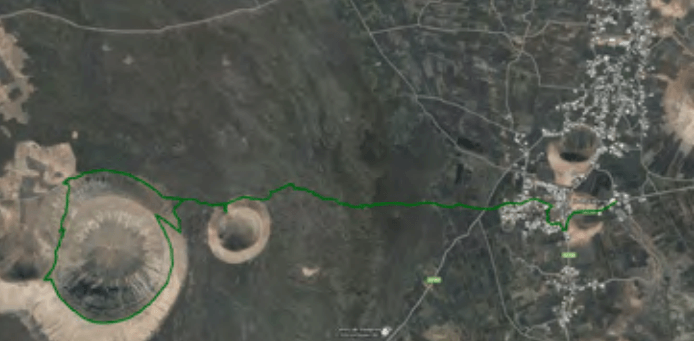
TECHNICAL DATA
- Distance: 10 km
- Duration: 3 hours
- Slope: 303 metres
- Difficulty: low

3. Los Ajaches
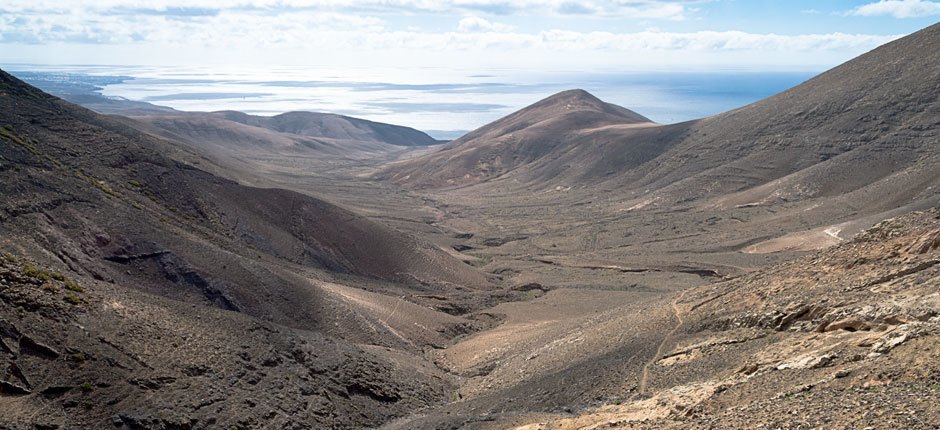
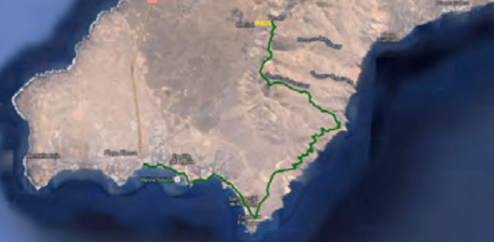
The third hiking route in Lanzarote runs through Los Ajaches in the southeast of the island, along a large volcanic formation with a massif on the leeward side and stony plains on the windward side. This trail, which starts in the village of Femés, has a considerable slope over path, track, pedestrian walkway and road.
This is an area of important archaeological heritage, with caves, engravings and traces of ancient pastoralism in the municipality of Yaiza. This area, the oldest in Lanzarote, continues to be subject to intense dismantling due to erosion, which over the last ten million years has carved out the ravines that this natural route crosses.
Its natural environment offers the possibility of discovering a flora formed by arid scrubland, with tabaibales in the most sheltered areas. Its fauna includes steppe birds and birds of prey, as well as marine birds on the coastal cliffs.
TECHNICAL DATA
- Distance: 20 km
- Duration: 5:30 hours
- Slope: 439 metres
- Difficulty: high
